Kazincbarcika
 |
Kazincbarcika was created during the Socialist industrialization, when several villages were unified with the aim of creating an industrial city to provide workers for the newly built Borsodi Vegyi Kombinát (a predecessor of today's BorsodChem). The village of Sajókazinc was first mentioned in 1240. It was a mainly agricultural village until 1850, when the first coal mine was opened. The village of Barcika came into existence with the unification of two villages, Upper- and Lower-Barcika. Although a mine was opened nearby, agriculture remained the villagers' main occupation until the 1920s, when a large power plant was built.
After World War II, Sajókazinc and Barcika were united under the name Kazincbarcika. In 1954 it was granted town status, and the nearby village of Berente was annexed. The town already had 11,000 residents. BorsodChem, founded in 1949, took an active role in developing the town, and its job opportunities drew people from all over the country.
In the 1970s Kazincbarcika already had 30,000 residents. In the 1980s mining and heavy industry faced a crisis, and the rate of unemployment was high. The district of Berente separated from the city and became an independent village, mainly due to the fact that Borsodchem was situated in this part of the town, but the residents felt more of its disadvantages than its advantages. Berente's secession from Kazincbarcika led to the newly independent village receiving the local taxes paid by the factory; it made Berente one of the richest villages in the country.
Map - Kazincbarcika
Map
Country - Hungary
 |
 |
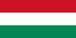
| Flag of Hungary | |
The territory of present-day Hungary has for centuries been a crossroads for various peoples, including Celts, Romans, Germanic tribes, Huns, West Slavs and the Avars. The foundation of the Hungarian state was established in the late 9th century AD with the conquest of the Carpathian Basin by Hungarian grand prince Árpád. His great-grandson Stephen I ascended the throne in 1000, converting his realm to a Christian kingdom. By the 12th century, Hungary became a regional power, reaching its cultural and political height in the 15th century. Following the Battle of Mohács in 1526, it was partially occupied by the Ottoman Empire (1541–1699). Hungary came under Habsburg rule at the turn of the 18th century, later joining with the Austrian Empire to form Austria-Hungary, a major power into the early 20th century.
Currency / Language
| ISO | Currency | Symbol | Significant figures |
|---|---|---|---|
| HUF | Hungarian forint | Ft | 2 |
| ISO | Language |
|---|---|
| HU | Hungarian language |


